


UAV SURVEYING SPECIALISTS
Aerial Survey Services
Sunrise Surveying is a land surveyor company that remains on the cutting edge of the industry, using our state-of-the-art UAVs to offer unrivalled uav surveying and mapping services.
UAV SURVEYS & AERIAL SURVEYING
Aerial Mapping
Visualising properties, roads, structures, and terrain is made much simpler with the help of advanced 3D modelling and aerial surveying technology. As a surveyor Toowoomba wide, we use cutting edge UAVs to assist clients with:
- Mapping and modelling of infrastructure corridors and assets
- Land development mapping
- 3D Terrain and topographical modelling
- Monitoring land movement
- Visual Inspections
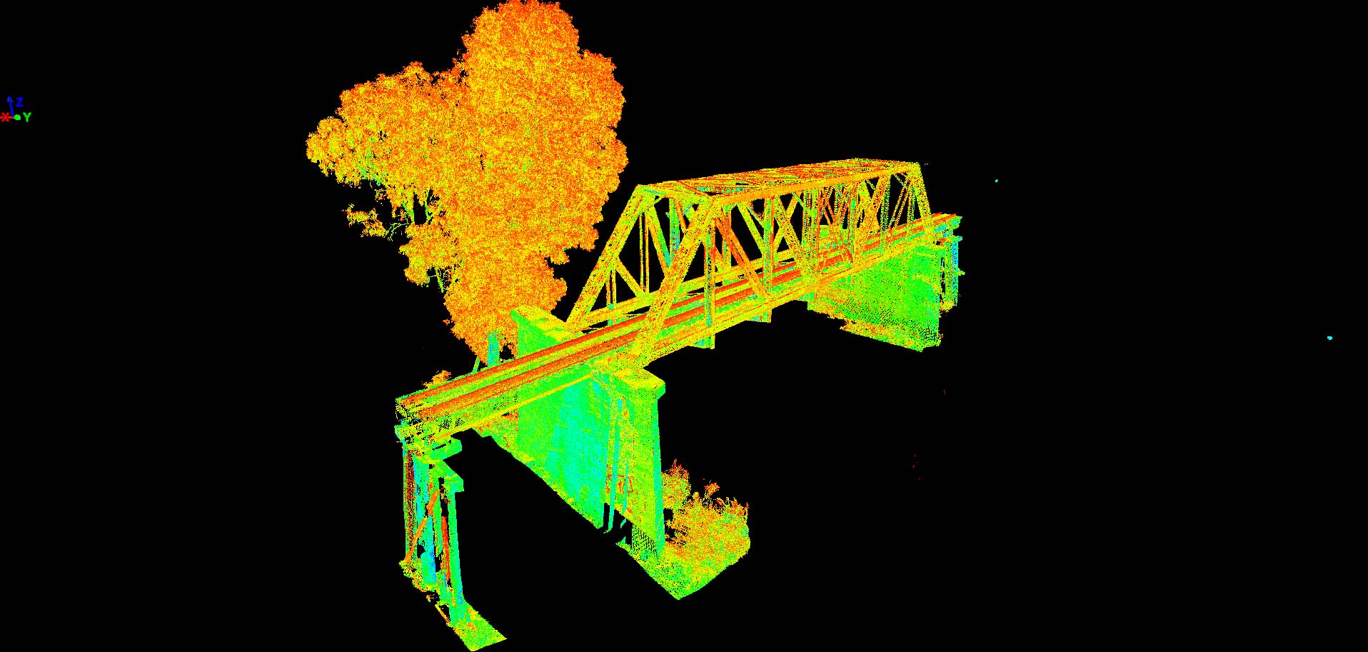
As part of our aerial survey services, our UAVs carry a range of photogrammetry and LIDAR equipment that allows us to create detailed 3D models of all projects, from residential constructions to large-scale mapping and infrastructure works.
Mapping and Modelling
If you’re building a house or working on a development project, Sunrise Surveying can deploy a team to capture the required data in an efficient and safe manner. As a surveyor Yeppoon wide, our aerial surveying can be used to define and deliver:
- Digital Terrain Models
- Point Clouds
- High Resolution Orthomosaics
- Digital Elevation Models
- Outlining adjacent properties and features
- Vegetation mapping
Our aerial mapping services and relevant deliverables provide the information needed for everything from individual house builds to complex commercial projects. Sunrise Surveying offers a comprehensive range of aerial surveying and uav surveying to residential builders, developers and civil project leaders.
Volumetric Surveys
Aerial volumetric surveys are a simple and cost-effective way of measuring the volume of materials and the capacity of features such as dams and landfills. Using state of the art UAVs, Sunrise Surveying can deliver high-accuracy volumetric project surveying of:
- Material stockpiles and quantities
- The capacity of dams, rivers and other waterways
- Mining materials and stock
- Stockpile auditing
- Excavation, earthworks and quarrying volumes
We pride ourselves on the quality of our aerial survey services by ensuring we deliver highly accurate measurements and consistent results. Volumetric surveys carried out by our team provide the information you need to make decisions and stay in control of your projects.

Accredited UAV Operators
Our Remotely Piloted Aircraft (RPA) operators are all accredited by the Civil Aviation Safety Authority (CASA), allowing us to deliver safe and compliant aerial mapping and UAV surveys. Thanks to the portability and easy deployment of drone technology, we are able to rapidly deploy our team to locations all over the Brisbane, Toowoomba, Sunshine Coast, Rockhampton and Yeppoon Regions.
The state-of-the-art UAVs employed by Sunrise Surveying form the backbone of many of our building and project surveying services. Our operators work across Brisbane, Toowoomba, Sunshine Coast, Rockhampton and Yeppoon where they can efficiently map out terrain, perform volumetric surveys and provide the data you need.
Speak to us about our aerial survey services for more information on our survey solutions.
Enquire Today
3D laser scanners form an important part of Sunrise Surveying’s services. Using laser scanners, we collect detailed data and create accurate models of a wide range of buildings, landscapes and other features. Contact our team today for more information on our engineering surveying services and how 3D laser scanners can inform your next project.
WHAT WE DO


Civil Construction & Engineering
3D Laser Scanning & Modelling
